The Zamboanga-based US JSOTF-P conducted aerial survey of the coastlines of Marabut in Samar towards Lawaan, Borongan, and Dolores towns in Eastern Samar – all the way up to the coastlines of Northern Samar and Southern Luzon

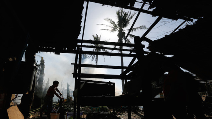
FIRST LANDFALL: Typhoon Ruby destroyed houses made of light materials and blew away roofs of buildings made of concrete
The nipa huts along the coastlines are destroyed. Houses made of concrete still stand but the roofs are gone. Schools and other government buildings also lost their roofs. There is no electricity.
Aerial rounds on Dolores and nearby Oras town in Eastern Samar conducted jointly by the Philippine military and the US Joint Special Operations Task Force - Philippines (JSOTF-P) on December 8 also showed "minimal movement of public utility vehicles" even as public roads and bridges were generally passable, said Armed Forces chief General Gregorio Catapang Jr during the Tuesday morning, December 9, briefing of the National Disaster Risk Reduction and Management Council (NDRRMC).
Typhoon Ruby made its first landfall in Dolores Saturday evening, December 6, packing maxium sustained winds of 175 km/h near the center and gustiness of up to 210 km/h. (WATCH: Video essay on Dolores)
Preemptive evacuation saved a lot of lives, said Catapang, quoting the report. "They observed that because of the early evacuation, a lot of lives were saved," he said. (READ: #RubyPH: One of 'largest peacetime evacuations' in PH history)
In Borongan City, located south of Dolores, damage to coconut crops was observed but the airport facilities are in relatively good condition, allowing C130 aircraft to land despite the initial challenges.
Images of Gamay town in Northern Samar also indicated "slight" damage, Catapang said. "Public roads and bridges are passable. The people are generally in good condition," he added.
Typhoon weakens
Ruby (Hagupit), which was originally forecast by some international weather agencies as a super typhoon, proved kinder considering the widespread fear evoked by the memory of Typhoon Yolanda (Haiyan) – the world's worst recorded typhoon to make landfall.
Yolanda flattened communities and killed over 6,000 people in the same typhoon path in November 2013.
"They conducted aerial photography and it will show that the typhoon did not do a lot of damage except for the light houses that are made of light materials," said Catapang.
Aerial survey from Samar to Bicol
Here's what they saw:
The area of Dolores and Borongan in Eastern Samar, where Ruby made first landfall
- Public and business structures appeared intact
- No major damage observed except for a few with missing roofs
- Roads were passable and tricycles were seen running together with a few 4x4 vehicles
- Electric posts were not damaged
- Piers, ports were intact with a few motor bancas berthed
- One bridge was observed earlier on the live feed as not usable to heavy vehicles due to erosion
- Only a few residential houses were observed with damage to their roofs
Northern coast of Samar
- Noticeable was the presence of smoke in open spaces, indicating burning of debris and rubbish
- It was still daytime; difficult to say they already had electric supply
- No public infrastructure was apparenly destroyed
- No houses had major damage; only a few had damaged roofs
- No fallen tree
Catarman in Northern Samar
- Residents near the airport were observed to be in high spirits, with many waving to the aircraft
- Houses were intact, no major damage
- Only a few houses had their roofs torn down
- No public and business infrastructure damaged
- Forced evacuation of residents prevented the loss of lives
Bicol area
- The southern coast of Bicol Region was untouched
- In Masbate, no damage was observed
- Numerous 4-wheel vehicles, tricycles, and people were seen in the central business district
Local teams are currently validating the information from the aerial survey, according to NDRRMC executive director Alexander Pama. "What is seen from the air needs to be validated on the ground by our rapid damage assessment teams. The primary purpose is to validate what relief items need to be sent there immediately," said Pama.
Catapang gave assurances that the military's C130 cargo planes are scheduled to make 10 sorties to transport the requirements.

No comments:
Post a Comment
Note: Only a member of this blog may post a comment.