
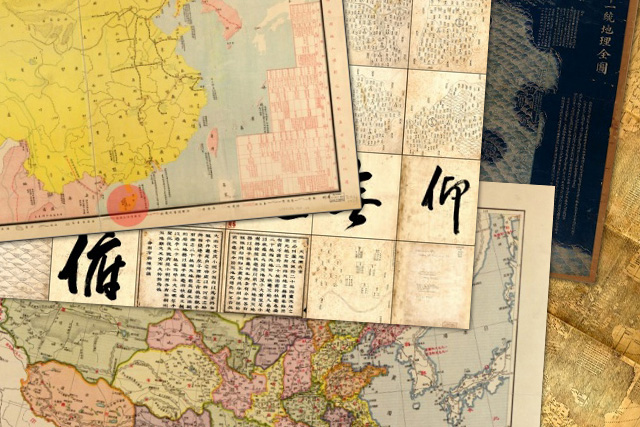
A cartographic exhibit of historical "truths and lies" Scarborough Shoal was presented by Supreme Court Senior Associate Justice Antonio Carpio on Thursday, Oct. 23, 2014.
Supreme Court Senior Associate Justice Antonio Carpio on Thursday presented anew publicly available maps defining the territorial boundaries of China from 1136 to 1933.
Carpio, who led the launching of the cartographic exhibit at the University of the Philippines Diliman, explained that one batch of maps (shown below) as those made by Chinese authorities or commissioned by the dynasties of old.
None of the maps indicates the disputed Kalyaan (Spratlys) Islands and the part of the South China Sea (West Philippine Sea) claimed by the Philippines, are covered by the Asian giant's sovereignty "since time immemorial," Carpio said.
Maps of China by Chinese authorities
All maps show Hainan Island (highlighted in red) as the southernmost territory of China.
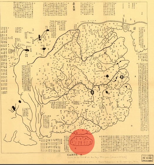
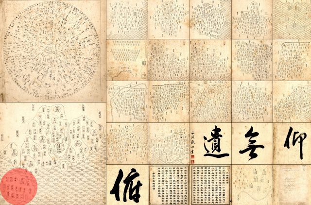
Map of China and the Barbarian Countries. Engraved in stone in Fuchang in about 1136 during the Nan Song Dynasty. It was transferred on print in France in 1903. Hainan Island as the southernmost part of China is highlighted. IMOA/A. Carpio/US Library of Congress
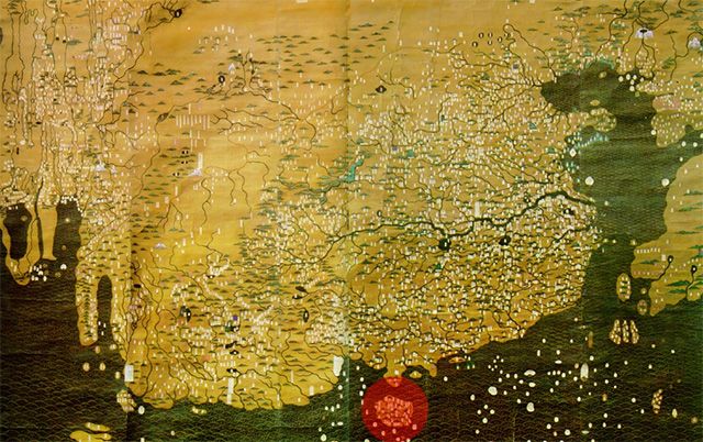
Great Ming Dynasty Amalgamated Map. Painted in color on silk and published in around 1389 during the Ming Dynasty. Again, it shows Hainan Island as the southernmost territory of China.Hong Kong Baptist University
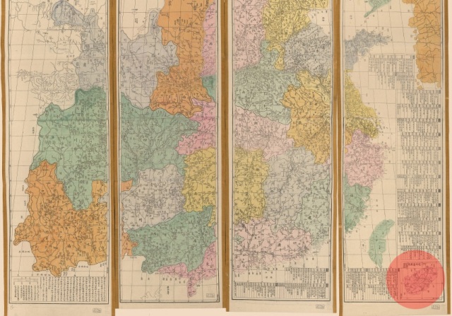
Atlas of the Ming Empire. The map, published between 1547 and 1559 by the Ming Dynasty, shows the then 13 provinces of China during the Jianjing period. Note that Taiwan is not included and Macau is not marked, while Hainan remains as the southernmost territory. US Library of Congress
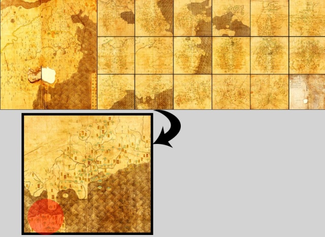
Atlas of Heaven and Earth. Published in 1601 by Junheng Zuo during the Ming Dynasty. Seen is Hainan Island as the southernmost part of China. US Library of Congress
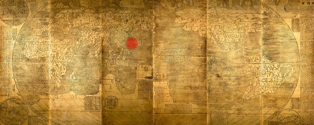
Map of the Myriad of Countries of the World. Created by Jesuit priest Matteo Ricci in 1602, who was commissioned by Ming Emperor Wanli. Ricci moved China to the center of the map to please his Chinese clients. The panels, however, can be rearranged so any part of the world can be placed at the center of the map. It again places Hainan as the southernmost territory. US Library of Congress
RELATED: What are China's motives in South China Sea?
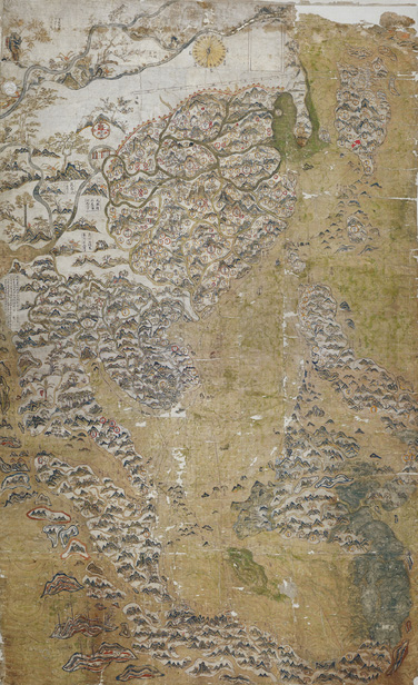
Selden Map of China. Published between 1606 and 1624 during the Ming Dynasty, the map was donated by English jurist and scholar John Selden to the University of Oxford in 1659 It shows China, South Asia, Southeast Asia and East Asia with South China Sea at the center . Bodleian Library, University of Oxford
Carpio called the Selden Map his "favorite" as it indicates the historical role of the now disputed South China Sea as an "important waterway that should be open to all nations."
The Great Qing Dynasty Complete Map of All Under Heaven. Published in China in 1811 by Qing Emperor Jiaqing showing Hainan, once again, marking the southernmost borders.US Library of Congress
READ: United States: China 'occupying' South China Sea areas, breaking vows
The Complete Geographical Map of the Great Qing Dynasty. Qianren Huang published this map in China between 1814 and 1816. Hainan Island marks the southernmost boundary of the dynasty.US Library of Congress
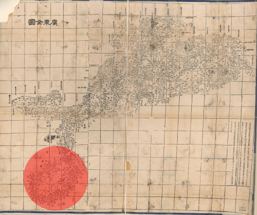
Complete Map of Guangdong Province. Published in Wuchang, China in 1864 by Hubei Sheng and Huan Shu Ju, the map also shows Hainan as the southernmost territory.US Library of Congress
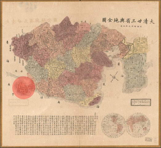
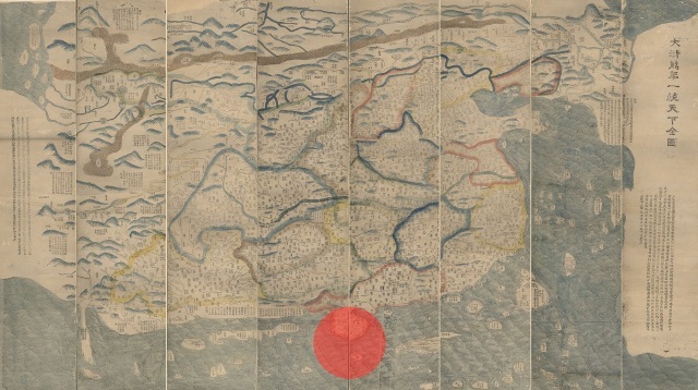
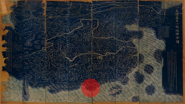
Complete Map of the Twenty Three Provinces of the Great Qing Dynasty. Published sometime after 1885 by the Qing Dynasty, the map is an "important" piece as China's claims it bases its territory on the Qing dynasty, Carpio said.US Library of Congress
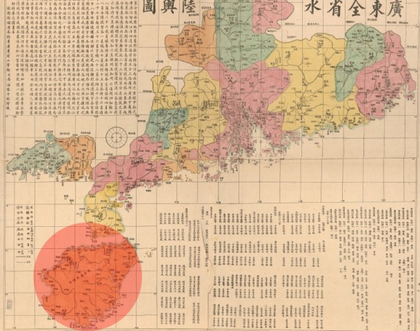
Map of the Waterways and Roads in Guangdong Province. On the upper left side of this map, published around 1887, is an annotation by cartographer Li Zhongpei.US Library of Congress
"Qiongzhou (name of Hainan Island at that time) is far from the mainland, has a coastline of more than 1,400 li (unit of distance in Chinese) and is the territory [of China] that ships navigating to China will encounter when coming from Southeast Asia," the annotation reads.
Qing Empire's Compelte Map of All Provinces. Hainan is shown as an inset in this map, published by Peilan Li in 1896, indicating it to be the southernmost part of its territory.US Library of Congress
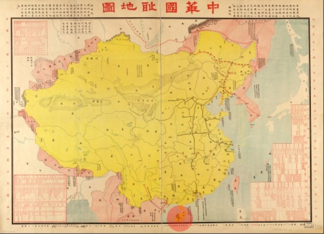
"Zhong Hua Guo Chi Di Tu." Published in 1929 in Beijing by Hebei Sheng and Gong Shang Ting, the map mentions treaties signed by China and the harbors opened to foreign powers. Again, Hainan Island is depicted as the southernmost territory.US Library of Congress
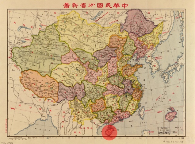
Map of the Provinces of China. Published around 1933 in Wuchang, China by Ya Xin Di Xue She, the illustration shows Hainan Island at the southernmost tip of the territory.US Library of Congress
"Throughout Chinese dynasties, China's territory never included the Spratly Islands and the Scarborough Shoal," Carpio, maritime law expert, said.
He said the existence of ancient Chinese maps disproved China's so-called historical claims based on the nine-dash line covering maritime features and areas the Philippines considers its own.
Carpio explained that the territory acknowledged in the maps are even enshrined in China's constitution until 1946 stating that the "territory of the Republic of China continues to be the traditional territory."
The current constitution of China, however, "no longer defines the territory because it keeps on expanding," Carpio said, referring to the Chinese's 2012 takeover of the Philippines' Scarborough Shoal, which is also called Bajo de Masinloc or Panatag Shoal.
--
All images are digital reproductions from the Institute of Maritime and Ocean Affairs, Philippines.
http://www.philstar.com/headlines/2014/10/24/1383940/chinas-old-maps-negate-own-historical-claims-over-spratlys
No comments:
Post a Comment
Note: Only a member of this blog may post a comment.