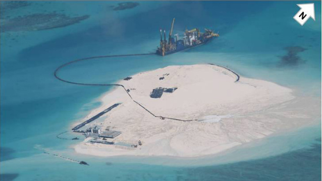
Turning Mabini Reef into an island can affect the Philippines' historic case against China, the Department of Foreign Affairs says

'JEOPARDIZING CASE.' The
The Philippines on Friday, May 16, said it fears the Chinese reclamation activities on Mabini (Johnson South) Reef is “jeopardizing” its historic case against China by turning the uninhabited rock into an island.
In a media
briefing, Philippine Department of Foreign Affairs (DFA) spokesman Charles Jose
said the Philippines relayed
this concern to China in its
latest diplomatic protest, which China
The Philippines protested against China 's construction of a suspected military
base on Mabini Reef, which is located in the Spratly
Islands in the disputed West
Philippine Sea (South China Sea ). (READ: PH: Spratlys 'airstrip' affirms case vs China)
He said the
diplomatic protest, filed on April 4, stated “that what they are doing is
jeopardizing our case, because what they're doing will change the nature and
character of that feature.”
"[This] will
somehow have an implication on the panel that was constituted to decide
objectively on this case,” Jose said.
He said
classifying Mabini as an island, instead of a rock, will broaden its maritime
entitlement to a 200-nautical mile (NM) exclusive economic zone (EEZ).
"Hindi dapat baguhin 'yung physical feature no'n," he said.
(They shouldn't change its physical feature.)
'Island'
tag favors China
In an interview
with Rappler in 2012, maritime law expert Jay Batongbacal explained that the
“island” tag can entitle China
This is likely why
China insists on calling
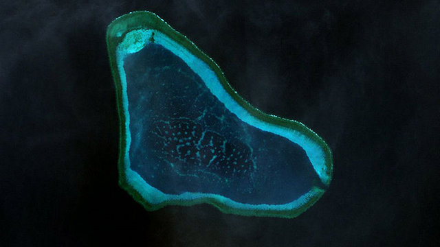
Panatag (Scarborough) Shoal, another disputed area, as Huangyan Island

DISPUTED AREA.
The UNCLOS defines an island as “a naturally formed area of land, surrounded by water, which is above water at high tide.”
Based on UNCLOS
and subject to certain conditions, an island or land territory is entitled to
the following waters:
a territorial sea
of up to 12 nautical miles (NM), with such a sea defined by the UN as a “belt
of sea adjacent to a State's coast”;
a contiguous, or
adjacent, zone of up to 24 NM from the State's baselines or “edges” from which
the breadth of the territorial sea is measured;
an EEZ of up to
200 NM from the baselines, within which a State has the sovereign rights to
explore and exploit, and conserve and manage natural resources, among others;
and
a continental
shelf comprising the seabed and subsoil of the submarine areas 200 NM from the
baselines
“If you want to
maximize your land area as well as your water area, you would want as many
islands as possible,” Batongbacal explained.
On the other
hand, the UNCLOS says, “Rocks which cannot sustain habitation or economic life
of their own shall have no exclusive economic zone or continental shelf.”
On Friday, Jose
said that aside from jeopardizing the Philippines
A non-binding
agreement, the Declaration on the Conduct of Parties in the South China Sea
(DOC) states: “The parties
undertake to exercise self-restraint in the conduct of activities that would
complicate or escalate disputes and affect peace and stability including, among
others, refraining from action of inhabiting on the presently uninhabited
islands, reefs, shoals, cays, and other features, and to handle their
differences in a constructive manner.”
Citing the DOC,
the United States
http://www.rappler.com/nation/58201-philippines-china-reclamation-jeopardize-case

No comments:
Post a Comment
Note: Only a member of this blog may post a comment.